24 Best Sights in Great Smoky Mountains National Park, NC, North Carolina

Andrews Bald

Fodor's choice

From the Clingmans Dome parking, taking the trail less traveled to Andrews Bald feels like being in on a secret. To get there, walk the 1.8-mile Forney Ridge Trail, a rocky path with an elevation gain of almost 600 feet. The payoff is several acres of grassy bald at more than 5,800 feet, with stunning views of Fontana Lake and the southeastern Smokies. This is one of only two balds in the Smokies that the park service keeps clear (the other is Gregory Bald). Difficult.

Big Creek Picnic Area

Fodor's choice

This is the smallest picnic area in the park, with only 10 picnic tables. The creek is wide and inviting, with small swimming holes and several channels that create tiny islands. The picnic area is accessible via Exit 451 off of Interstate 40 or the unpaved Cove Creek Road from Cataloochee. There's a small campground here and restrooms but no pavilion. Several good hiking trails begin here, and the Appalachian Trail crosses the road near the entrance at Davenport Gap.

Cataloochee Valley

Fodor's choice
Cataloochee Valley
Danny R. Buxton / Shutterstock

This is one of the most memorable and eeriest sights in all of the Smokies. At one time Cataloochee was a community of more than 1,200 people. After the land was annexed for the national park in 1934, the community dispersed. Although many of the original buildings are gone, more than a dozen houses, cabins, barns, and churches still stand. You can visit the Palmer Methodist Chapel, the Beech Grove School, and the Woody, Caldwell, and Messer homesteads. You have a good chance of spotting elk here, especially in the evening and early morning. You'll also likely see wild turkeys, deer, and perhaps bears. Cataloochee is one of the most remote parts of the Smokies, reachable by car via a narrow, winding gravel road that rises over a steep pass before dropping you into the isolated valley. Take the 5 mph speed limit seriously on the blind curves. At dawn and dusk, this uncrowded valley is pure beautiful magic. 

Recommended Fodor's Video

Cataloochee Valley Overlook

Fodor's choice

This is a great spot to take in the broad expanse of Cataloochee Valley. Cataloochee comes from a Cherokee word meaning "row upon row" or "standing in rows," and indeed you'll see rows of mountain ridges here. The overlook is well marked and has a split-rail fence.

Deep Creek Picnic Area

Fodor's choice

Deep Creek offers more than picnicking. You can go tubing (rent a tube for the day for around $5 or $6 at nearby commercial tubing centers), hike about two miles to three pretty waterfalls, or go trout fishing. You can even go mountain biking here, as this is one of the few park trails where bikes are allowed. The picnic area, open year-round (but no running water in winter), has 58 picnic tables, plus a pavilion that seats up to 70 (reserve in advance, $32 fee). There's also a campground here.

Gregory Bald

Fodor's choice

From almost 5,000 feet on Gregory Bald, you have a breathtaking view of Cades Cove and Rich Mountain to the north and Fontana Lake to the southeast. Gregory Bald is one of only two balds in the Smokies that are kept clear of tree growth by the Park Service. This is a view that just a few thousand people a year will see, as it's reachable only by a strenuous 11.2-mile roundtrip hike via the Gregory Ridge Trail, with 2,700 feet of elevation gain. The trailhead is at the end of Forge Creek Road in Cades Cove. In early summer, this difficult hike through old-growth forests to Gregory Bald offers an astounding display of hybrid flame azaleas. Difficult.

Heintooga Picnic Area

Fodor's choice

Located at more than a mile high and set in a stand of spruce and fir, the picnic area has 41 tables. Nearby is Mile High Overlook, which offers one of the most scenic views of the Smokies and is a wonderful place to enjoy the sunset. For birders, this is a good spot to see golden-crowned kinglets, red-breasted nuthatches, and other species that prefer higher elevations. Nearby are a campground and trailheads for several good hiking trails, including Flat Creek. The disadvantage is that, due to the high elevation (and the risk of snow and ice), the picnic area is open only from late May to mid-October.

Mountain Farm Museum

Fodor's choice

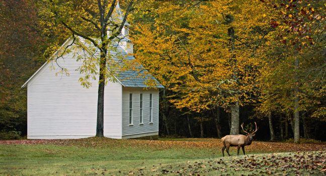
This is perhaps the best re-creation anywhere of an Appalachian mountain farmstead. The nine farm buildings, all dating from the late 19th century, were moved in the 1950s to this site next to the Oconaluftee Visitor Center from various locations within the park. Besides a furnished two-story chestnut log cabin, there is a barn, apple house, corncrib, smokehouse, bee gums, springhouse, chicken coop, and other outbuildings. In season, corn, tomatoes, pole beans, squash, and other mountain crops are grown in the garden, and the park staff sometimes puts on demonstrations of pioneer activities, such as making apple butter and molasses. Two easy 1½-mile walking trails begin near the museum. Dogs on leashes are allowed on the trail but not within the farm grounds. Elk are sometimes seen grazing in the pastures adjoining the farm, and occasionally you may see white-tailed deer and wild turkeys.   This is an extremely popular place to visit, but in the evening after the visitor center closes, you're likely to have it to yourself.

Mt. Sterling

Fodor's choice

A 5.4-mile round-trip hike takes you to an old fire watchtower, rewarding you with amazing views. The route is steep, with an elevation gain of almost 2,000 feet, so you should consider this a strenuous challenging hike. Difficult.

Newfound Gap Overlook

Fodor's choice
At 5,048 feet, Newfound Gap is a drivable pass through the top of the park and provides excellent views of a broad swath of the Smokies. The ridge at Newfound Gap marks the North Carolina–Tennessee state line. If you want to say you’ve been on the Appalachian Trail, it's a short and easy walk away here. Franklin Delano Roosevelt officially dedicated the park at this site in 1940.

Oconaluftee Visitor Center

Fodor's choice

The park's main information center on the North Carolina side is polished and inviting after a $3 million renovation and expansion. It is 1½ miles from Cherokee and offers interactive displays, a 20-minute film, a large book and gift shop, ranger-led programs, and assistance from helpful volunteers. There are restrooms and vending machines. Adjoining the visitor center, in a large level field next to the Oconaluftee River, is the Mountain Farm Museum, a reconstruction of an early 1900s mountain farmstead. Herds of elk are often seen here.

Big Witch Overlook

This overlook on the Blue Ridge Parkway offers fine views of the eastern side of the Smokies, and in May and June the roadsides bloom with rosebay rhododendron.

Collins Creek Picnic Area

The largest developed picnic area in the park, Collins Creek has 182 picnic tables. Collins Creek, which runs near the picnic area, is a small stream with above-average trout fishing (license required). The site has restrooms with flush toilets, potable water, and a 70-seat pavilion for groups that can be reserved in advance for $32.

Flat Creek Trail

This is one of the hidden gems in the park. It's a little known but delightful hike, especially in summer when the higher elevation means respite from stifling temperatures. The 2.6-mile path stretches through pretty woodlands with evergreens, birch, rhododendron, and wildflowers. The elevation gain is about 570 feet. Moderate.

Heintooga Ridge Rd., North Carolina, 28719, USA
865-436–1200
sights Details
Rate Includes: Heintooga Ridge Rd. closed Nov.--late May

Heintooga Overlook

One of the best spots to watch the sunset, Heintooga Overlook has sweeping views westward of the crest of the Great Smokies.

Heintooga Ridge Rd., North Carolina, 28719, USA
865-436–1200
sights Details
Rate Includes: Closed Nov.–late May

Kephart Prong Trail

A 4.2-mile round-trip woodland trail named for Horace Kephart, a writer and early promoter of the park, wanders beside a stream to the remains of a Civilian Conservation Corps camp. Close by, the trail takes a moderate slope to Mt. Kephart, gaining over 900 feet in elevation. Moderate.

Little Cataloochee Trail

No other hike in the Smokies offers a cultural and historic experience quite like this one. In the early 20th century, Cataloochee Cove had the largest population of any place in the Smokies, around 1,200 people. Most of the original structures have been torn down or have succumbed to the elements, but a few historic frame buildings remain along this remote trail. Some have been restored by the park staff, such as the Cook Log Cabin near Davidson Gap, an apple house, and a church. You'll see several of these, along with rock walls and other artifacts, on the Little Cataloochee Trail. The trail is six miles each way, including a mile-long section of Pretty Hollow Gap Trail. Allow at least six hours for this hike. Moderate.

Mingus Mill

In the late 19th century this was a state-of-the-art gristmill, with two large grist stones powered by a store-bought turbine rather than a hand-built wheel. From mid-March to just after Thanksgiving, you can watch the miller make cornmeal and even buy a pound of it.

Newfound Gap Road

Newfound Gap Road (U.S. 441) is by far the busiest road on the national park's North Carolina side, with more than a million vehicles making the 16-mile climb from an elevation of 2,000 feet near Cherokee to almost a mile high at Newfound Gap (and then down to Gatlinburg on the Tennessee side). It's the only paved road that goes all the way through the center of the park, so you definitely won't escape from the crowds. Mile markers run backward (as far as North Carolinians are concerned), starting at 31.1 where it intersects with the Blue Ridge Parkway near Cherokee. Among the sights on the road are the Oconaluftee Visitor Center and Mountain Farm Museum (mile marker 30.3); Mingus Mill (mile marker 29.9); Smokemont Campground and Nature Trail (mile marker 27.2); Web Overlook (mile marker 17.7), from which there's a good view almost due west of Clingmans Dome; and Newfound Gap (mile marker 14.7), the start of the seven-mile road to Clingmans Dome. The speed limit on Newfound Gap Road tops out at 45 mph.

Oconaluftee Valley Overlook

Oconaluftee Valley Overlook
MarkVanDykePhotography / Shutterstock

From atop the Thomas Divide, just a little below the crest of the Smokies, you can look down at winding Newfound Gap Road. This is also a good spot to view the sunrise.

Proctor

Once a thriving lumber and copper mining town on Hazel Creek, Proctor has mostly been taken over by nature. Among the structures remaining are the white-frame Calhoun House, probably built in the early 1900s; the foundations of a church and of several other buildings; and bridges over Hazel Creek. About half a mile away is the Proctor cemetery. Proctor is best reached by boat across Fontana Lake. After arriving on the north shore of the lake, it’s a short walk to the site of the old town. Fontana Marina offers daily boat transport across the lake.

Road to Nowhere

Lakeview Drive was originally proposed as a way for local communities to reach their family cemeteries, after being displaced from their homes for the Fontana Dam project in the 1940s. An environmental issue halted the construction of Lakeview Drive, earning it its nickname as the “Road to Nowhere.” Today, the road begins at the park's entrance from Fontana Road in Bryson City, and ends at a tunnel six miles into the park. The drive is quite scenic, with an overlook of Fontana Lake and a few trailheads along the way. A network of hiking trails (including a 3.2-mile loop) begin at the tunnel.  It's surprisingly dark and eerie in the tunnel, especially if you're there alone. If you end a loop hike at the tunnel and don't want to walk through it, there's a bypass trail.

Smokemont Loop Trail

A 6.1-mile round-trip loop takes you by streams and, in spring and summer, lots of wildflowers, including trailing arbutus. At Smokemont Campground near Cherokee, this is an easy trail to access. The only downside is that there are no long-range views. Moderate.

Twentymile Loop Trail

The national park's Twentymile entrance on the northern side of Cheoah Lake is its most difficult to reach, and thus the least crowded. This is an incredible area of the park, especially during spring when the flowers and wild azaleas bloom. An easily manageable 7.2-mile loop follows old logging roads along Twentymile Creek and Moore Springs Branch, connecting via the Twentymile Loop Trail. The elevation gain is minimal, but the solitude and serenity found along the creeks (there are multiple swimming holes) is a local secret. Moderate.